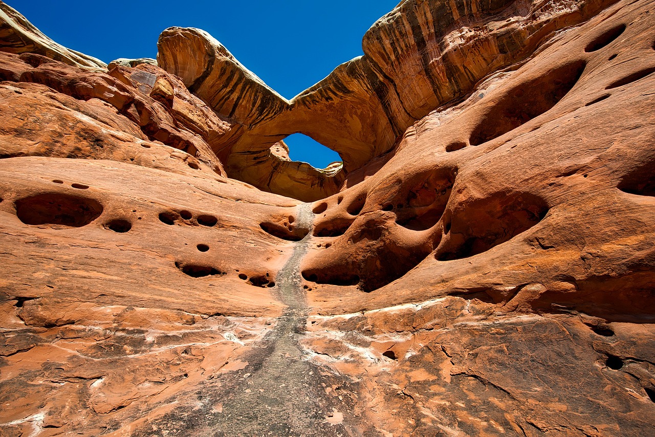
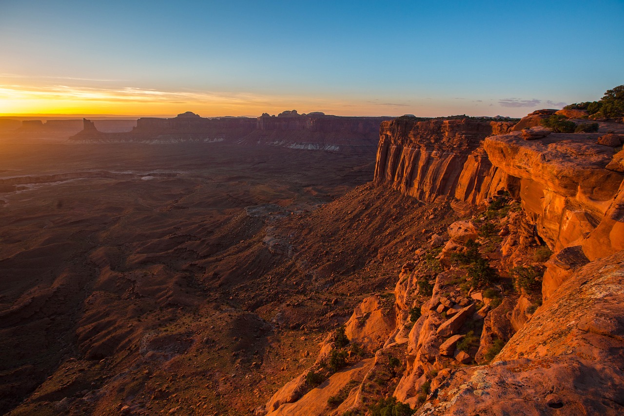
Canyonlands National Park, carved by the Colorado River and its tributaries, reveals the raw power of water and time. Situated in southeastern Utah, this sprawling park is divided into four distinct districts: Island in the Sky, The Needles, The Maze, and the rivers themselves, each offering its own unique adventure and geological spectacle. Island in the Sky sits atop a massive mesa, presenting sweeping vistas over the sprawling canyons below, while The Needles district is characterized by its colorful spires of Cedar Mesa Sandstone that jut up from the ground like ancient earthbound stars. The Maze, known for its labyrinthine canyons, is one of the most remote and challenging areas to explore in the United States, offering unparalleled solitude and backcountry adventure.
The confluence of the Colorado and Green Rivers cuts through the heart of the park, shaping the landscape and serving as a critical lifeline for the area's flora and fauna. Petroglyphs etched into rock faces by ancient Native American cultures add a layer of human history to this stark and natural canvas. Canyonlands is not only a testament to the natural forces that shape our world but also a sanctuary for those seeking the thrill of exploration, the beauty of untouched nature, and the quiet that comes with grand, open spaces.
Biome at Canyonlands National Park
Canyonlands National Park, located in Utah, is a unique and diverse ecosystem that spans multiple biomes. The park's vast territory encompasses a range of elevations, from 3,000 to 6,000 feet (914 to 1,829 meters) above sea level, which supports a variety of biomes. Keep on reading to learn more about the biomes at Canyonlands National Park
Airports Near Canyonlands National Park
This is a list of the closest airports to the park, if you plan on flying into Canyonlands click here to read our recommendations.
| Distance to Park | Drive Time | ||
| Canyonlands Regional Airport | 42.2 miles | 29 mins | Get Directions |
| Green River Municipal Airport | 105.2 miles | 1 hour 9 mins | Get Directions |
| Blanding Municipal Airport | 112.7 miles | 1 hour 20 mins | Get Directions |
| Bullfrog Basin Airport | 171.0 miles | 5 hours 34 mins | Get Directions |
| Cortez Municipal Airport | 177.8 miles | 2 hours 0 mins | Get Directions |
| Hanksville Airport | 188.3 miles | 1 hour 49 mins | Get Directions |
| Carbon County Regional/Buck Davis Field | 195.7 miles | 2 hours 0 mins | Get Directions |
| Grand Junction Regional Airport | 195.9 miles | 1 hour 52 mins | Get Directions |
Cities Near Canyonlands National Park
Here are some of the closest cities and towns near the park, take a look at our recommendations for where to stay when visiting Canyonlands.

| Distance to Park | ||
| Moab | 53.4 miles | Get Directions |
| Monticello | 63.0 miles | Get Directions |
| Blanding | 75.3 miles | Get Directions |
| Green River | 90.7 miles | Get Directions |
| Castle Dale | 147.0 miles | Get Directions |
| Fruita | 149.1 miles | Get Directions |
| Cortez | 151.5 miles | Get Directions |
| Grand Junction | 152.9 miles | Get Directions |
| Kayenta / Tó Dínéeshzheeʼ | 166.8 miles | Get Directions |
| Price | 173.3 miles | Get Directions |
Canyonlands National Park TimeZone
The timezone at Canyonlands is America/Denver, the current time here is:
Sunrise and Sunset Times at Canyonlands National Park
This table shows the sunrise and sunset times at Canyonlands for the next 10 days, use it to plan your day around Canyonlands stunning displays.
|
Date |
Sunrise |
Sunset |
| January 30, 2026 | 07:24 | 17:41 |
| January 31, 2026 | 07:23 | 17:42 |
| February 01, 2026 | 07:22 | 17:43 |
| February 02, 2026 | 07:21 | 17:45 |
| February 03, 2026 | 07:20 | 17:46 |
| February 04, 2026 | 07:19 | 17:47 |
| February 05, 2026 | 07:18 | 17:48 |
| February 06, 2026 | 07:17 | 17:49 |
| February 07, 2026 | 07:16 | 17:50 |
| February 08, 2026 | 07:15 | 17:51 |
Weather at Canyonlands National Park
This table shows weather averages around the year at Canyonlands National Park, it provides information on average rainfall, as well as maximum and minimum temperatures. Be sure to consult it when planning your trip.
|
Month |
Temperatures |
Precipitation |
Our Opinion |
|---|---|---|---|
|
Month |
Temperatures |
Precipitation |
Our Opinion |
|
Month |
Temperatures |
Precipitation |
Our Opinion |
|
Month |
Temperatures |
Precipitation |
Our Opinion |
|
Month |
Temperatures |
Precipitation |
Our Opinion |
|
Month |
Temperatures |
Precipitation |
Our Opinion |
|
Month |
Temperatures |
Precipitation |
Our Opinion |
|
Month |
Temperatures |
Precipitation |
Our Opinion |
|
Month |
Temperatures |
Precipitation |
Our Opinion |
|
Month |
Temperatures |
Precipitation |
Our Opinion |
|
Month |
Temperatures |
Precipitation |
Our Opinion |
| January | -7.2 °C / 2.8 °C | 4.5mm | Bad Weather |
| February | -4.2 °C / 8.2 °C | 3.5mm | Bad Weather |
| April | 4.1 °C / 19.5 °C | 3.9mm | Good Weather |
| May | 9.8 °C / 25.2 °C | 0.7mm | Perfect Weather |
| June | 16.4 °C / 32.9 °C | 2.0mm | Perfect Weather |
| July | 20.5 °C / 35.7 °C | 5.7mm | Bad Weather |
| August | 18.4 °C / 33.5 °C | 8.0mm | Bad Weather |
| September | 13.8 °C / 29.6 °C | 7.4mm | Perfect Weather |
| October | 5.4 °C / 19.3 °C | 13.4mm | Good Weather |
| November | -1.7 °C / 12.5 °C | 4.4mm | Bad Weather |
| December | -7.1 °C / 4.5 °C | 15.3mm | Bad Weather |
