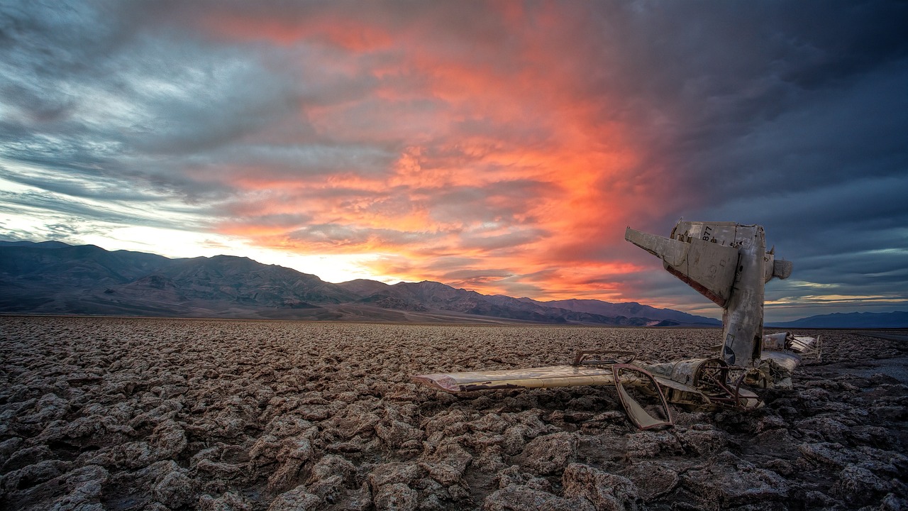
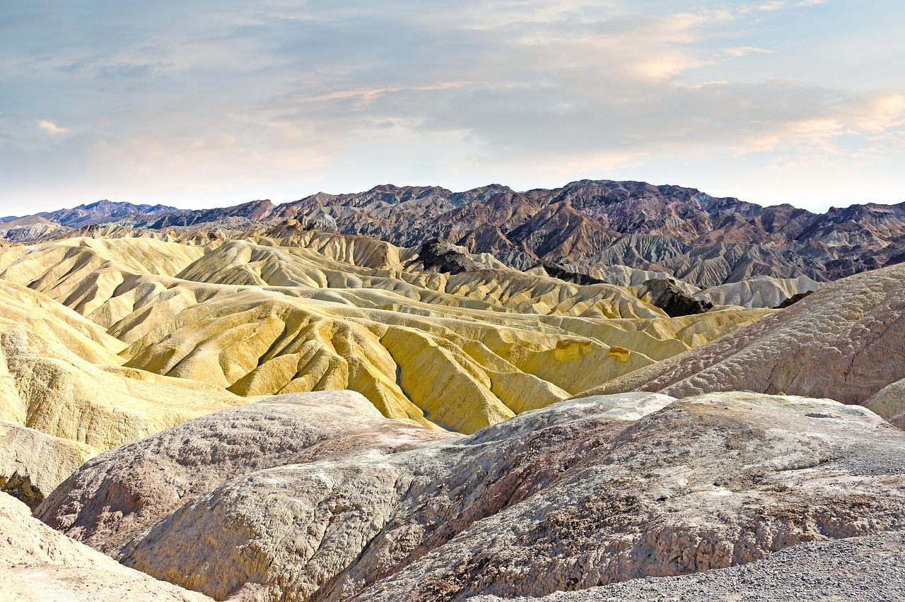
Death Valley National Park, a striking contrast of extremes, is a land of record summer heat, stunning sand dunes, and vibrant wildflower blooms following rare rainfalls. Encompassing the lowest point in North America at Badwater Basin, which lies 282 feet below sea level, the park showcases unique geological features including salt flats, volcanic craters, and canyons.
Death Valley's landscape is further characterized by its expansive desert vistas, towering mountains, and the rare and resilient species adapted to its harsh environment. The park is also home to historic sites related to the Timbisha Shoshone tribe and the California Gold Rush era. Within this diverse terrain, habitats range from vast, arid deserts to oasis-like springs, supporting a surprising variety of wildlife and plant species adapted to extreme conditions.
Biome at Death Valley National Park
Death Valley National Park, located in California and Nevada, is a unique and harsh environment that supports a variety of biomes. The park's vast territory encompasses a range of elevations, from 190 to 11,049 feet (58 to 3,368 meters) above sea level, which supports a variety of biomes. Keep on reading to learn more about the biomes at Death Valley
Airports Near Death Valley National Park
This is a list of the closest airports to the park, if you plan on flying into Death Valley click here to read our recommendations.
| Distance to Park | Drive Time | ||
| Beatty Airport | 55.2 miles | 42 mins | Get Directions |
| Creech Afb Airport | 169.5 miles | 1 hour 40 mins | Get Directions |
| Inyokern Airport | 200.8 miles | 2 hours 23 mins | Get Directions |
| Mojave Air & Space Port/Rutan Field | 280.1 miles | 3 hours 10 mins | Get Directions |
| Barstow-Daggett Airport | 286.1 miles | 3 hours 9 mins | Get Directions |
| Edwards Afb Airport | 286.2 miles | 3 hours 14 mins | Get Directions |
| General Wm J Fox Airfield | 322.8 miles | 3 hours 35 mins | Get Directions |
| Bicycle Lake Army Air Field | 343.3 miles | 3 hours 45 mins | Get Directions |
Cities Near Death Valley National Park
Here are some of the closest cities and towns near the park, take a look at our recommendations for where to stay when visiting Death Valley.

| Distance to Park | ||
| Beatty | 74.5 miles | Get Directions |
| Pahrump | 75.0 miles | Get Directions |
| Ridgecrest | 103.1 miles | Get Directions |
| Baker | 127.5 miles | Get Directions |
| Summerlin South | 133.9 miles | Get Directions |
| Yermo | 148.4 miles | Get Directions |
| Barstow | 150.3 miles | Get Directions |
| California City | 162.6 miles | Get Directions |
| Rosamond | 195.4 miles | Get Directions |
Death Valley National Park TimeZone
The timezone at Death Valley is America/Los_Angeles, the current time here is:
Sunrise and Sunset Times at Death Valley National Park
This table shows the sunrise and sunset times at Death Valley for the next 10 days, use it to plan your day around Death Valley stunning displays.
|
Date |
Sunrise |
Sunset |
| January 30, 2026 | 06:48 | 17:13 |
| January 31, 2026 | 06:47 | 17:14 |
| February 01, 2026 | 06:46 | 17:15 |
| February 02, 2026 | 06:45 | 17:16 |
| February 03, 2026 | 06:44 | 17:17 |
| February 04, 2026 | 06:44 | 17:18 |
| February 05, 2026 | 06:43 | 17:19 |
| February 06, 2026 | 06:42 | 17:20 |
| February 07, 2026 | 06:41 | 17:21 |
| February 08, 2026 | 06:40 | 17:22 |
Weather at Death Valley National Park
This table shows weather averages around the year at Death Valley National Park, it provides information on average rainfall, as well as maximum and minimum temperatures. Be sure to consult it when planning your trip.
|
Month |
Temperatures |
Precipitation |
Our Opinion |
|---|---|---|---|
|
Month |
Temperatures |
Precipitation |
Our Opinion |
|
Month |
Temperatures |
Precipitation |
Our Opinion |
|
Month |
Temperatures |
Precipitation |
Our Opinion |
|
Month |
Temperatures |
Precipitation |
Our Opinion |
|
Month |
Temperatures |
Precipitation |
Our Opinion |
|
Month |
Temperatures |
Precipitation |
Our Opinion |
|
Month |
Temperatures |
Precipitation |
Our Opinion |
|
Month |
Temperatures |
Precipitation |
Our Opinion |
|
Month |
Temperatures |
Precipitation |
Our Opinion |
|
Month |
Temperatures |
Precipitation |
Our Opinion |
|
Month |
Temperatures |
Precipitation |
Our Opinion |
| January | 0.8 °C / 13.7 °C | 17.2mm | Bad Weather |
| February | 2.3 °C / 15.5 °C | 23.9mm | Good Weather |
| March | 5.2 °C / 19.6 °C | 15.8mm | Good Weather |
| April | 8.3 °C / 23.5 °C | 8.4mm | Perfect Weather |
| May | 13.1 °C / 28.8 °C | 4.7mm | Perfect Weather |
| June | 18.2 °C / 34.8 °C | 3.1mm | Bad Weather |
| July | 22.0 °C / 38.2 °C | 8.0mm | Bad Weather |
| August | 21.0 °C / 37.1 °C | 10.0mm | Bad Weather |
| September | 16.6 °C / 32.8 °C | 9.6mm | Perfect Weather |
| October | 10.1 °C / 25.6 °C | 9.8mm | Perfect Weather |
| November | 3.6 °C / 18.0 °C | 6.8mm | Good Weather |
| December | 0.2 °C / 12.8 °C | 16.0mm | Bad Weather |
