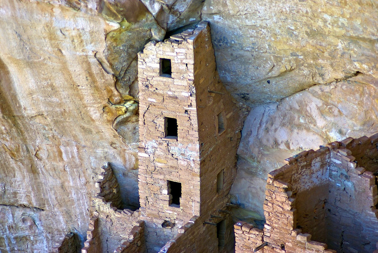
Located in the southwestern corner of Colorado, Mesa Verde National Park offers a spectacular look into the lives of the Ancestral Pueblo people who made this area their home for over 700 years, from 600 to 1300 CE.
The park protects nearly 5,000 known archeological sites, including 600 cliff dwellings, which are some of the most notable and best-preserved in the United States. These ancient structures, built into alcoves and perched on cliff faces, showcase a remarkable architectural, cultural, and historical legacy.
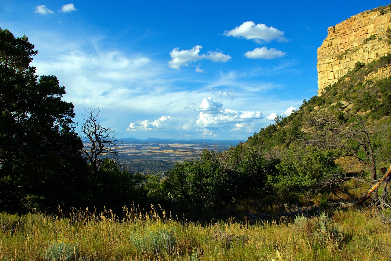
Beyond its rich cultural heritage, Mesa Verde encompasses a diverse landscape of high plateaus, steep canyons, and panoramic vistas that stretch over 52,485 acres. The park's elevation ranges from about 6,000 to over 8,500 feet, supporting a variety of plant and animal life adapted to its semi-arid environment. From the juniper and piñon pine forests to the sweeping views from Park Point, the highest point in the park, Mesa Verde National Park offers a unique combination of natural beauty and historical depth.
Biome at Mesa Verde National Park
Mesa Verde National Park, located in Colorado, offers a captivating glimpse into the lives of the Ancestral Pueblo people. The park's diverse landscape includes several biomes that are shaped by its elevation, climate, and geographic features. Keep on reading to learn more about the biomes at Mesa Verde National Park
Airports Near Mesa Verde National Park
This is a list of the closest airports to the park, if you plan on flying into Mesa Verde click here to read our recommendations.
| Distance to Park | Drive Time | ||
| Cortez Municipal Airport | 24.0 miles | 20 mins | Get Directions |
| Durango-La Plata County Airport | 78.8 miles | 54 mins | Get Directions |
| Animas Air Park | 97.7 miles | 1 hour 21 mins | Get Directions |
| Four Corners Regional Airport | 110.8 miles | 1 hour 13 mins | Get Directions |
| Telluride Regional Airport | 131.5 miles | 1 hour 34 mins | Get Directions |
| Stevens Field | 150.9 miles | 1 hour 41 mins | Get Directions |
| Blanding Municipal Airport | 151.1 miles | 1 hour 38 mins | Get Directions |
| Montrose Regional Airport | 230.7 miles | 2 hours 47 mins | Get Directions |
Cities Near Mesa Verde National Park
Here are some of the closest cities and towns near the park, take a look at our recommendations for where to stay when visiting Mesa Verde.

| Distance to Park | ||
| Cortez | 20.6 miles | Get Directions |
| Mancos | 25.3 miles | Get Directions |
| Shiprock / Naatʼáanii Nééz | 47.1 miles | Get Directions |
| Durango | 55.4 miles | Get Directions |
| Farmington | 56.2 miles | Get Directions |
| Aztec | 59.4 miles | Get Directions |
| Bloomfield | 68.8 miles | Get Directions |
| Blanding | 100.3 miles | Get Directions |
| Telluride | 103.3 miles | Get Directions |
| Monticello | 107.7 miles | Get Directions |
Mesa Verde National Park TimeZone
The timezone at Mesa Verde is America/Denver, the current time here is:
Sunrise and Sunset Times at Mesa Verde National Park
This table shows the sunrise and sunset times at Mesa Verde for the next 10 days, use it to plan your day around Mesa Verde stunning displays.
|
Date |
Sunrise |
Sunset |
| January 30, 2026 | 07:16 | 17:37 |
| January 31, 2026 | 07:15 | 17:39 |
| February 01, 2026 | 07:15 | 17:40 |
| February 02, 2026 | 07:14 | 17:41 |
| February 03, 2026 | 07:13 | 17:42 |
| February 04, 2026 | 07:12 | 17:43 |
| February 05, 2026 | 07:11 | 17:44 |
| February 06, 2026 | 07:10 | 17:45 |
| February 07, 2026 | 07:09 | 17:46 |
| February 08, 2026 | 07:08 | 17:47 |
Weather at Mesa Verde National Park
This table shows weather averages around the year at Mesa Verde National Park, it provides information on average rainfall, as well as maximum and minimum temperatures. Be sure to consult it when planning your trip.
|
Month |
Temperatures |
Precipitation |
Our Opinion |
|---|---|---|---|
|
Month |
Temperatures |
Precipitation |
Our Opinion |
|
Month |
Temperatures |
Precipitation |
Our Opinion |
|
Month |
Temperatures |
Precipitation |
Our Opinion |
|
Month |
Temperatures |
Precipitation |
Our Opinion |
|
Month |
Temperatures |
Precipitation |
Our Opinion |
|
Month |
Temperatures |
Precipitation |
Our Opinion |
|
Month |
Temperatures |
Precipitation |
Our Opinion |
|
Month |
Temperatures |
Precipitation |
Our Opinion |
|
Month |
Temperatures |
Precipitation |
Our Opinion |
|
Month |
Temperatures |
Precipitation |
Our Opinion |
|
Month |
Temperatures |
Precipitation |
Our Opinion |
| January | -6.9 °C / 5.5 °C | 0.0mm | Bad Weather |
| February | -4.2 °C / 9.6 °C | 0.0mm | Bad Weather |
| March | -0.9 °C / 12.8 °C | 0.0mm | Bad Weather |
| April | 2.4 °C / 19.3 °C | 0.0mm | Good Weather |
| May | 7.1 °C / 24.3 °C | 0.0mm | Perfect Weather |
| June | 12.9 °C / 31.8 °C | 0.0mm | Perfect Weather |
| July | 17.1 °C / 33.7 °C | 0.0mm | Bad Weather |
| August | 15.9 °C / 31.9 °C | 0.0mm | Perfect Weather |
| September | 11.1 °C / 27.6 °C | 0.0mm | Perfect Weather |
| October | 3.4 °C / 20.2 °C | 0.0mm | Good Weather |
| November | -2.4 °C / 13.3 °C | 0.0mm | Bad Weather |
| December | -9.6 °C / 5.0 °C | 0.0mm | Bad Weather |
