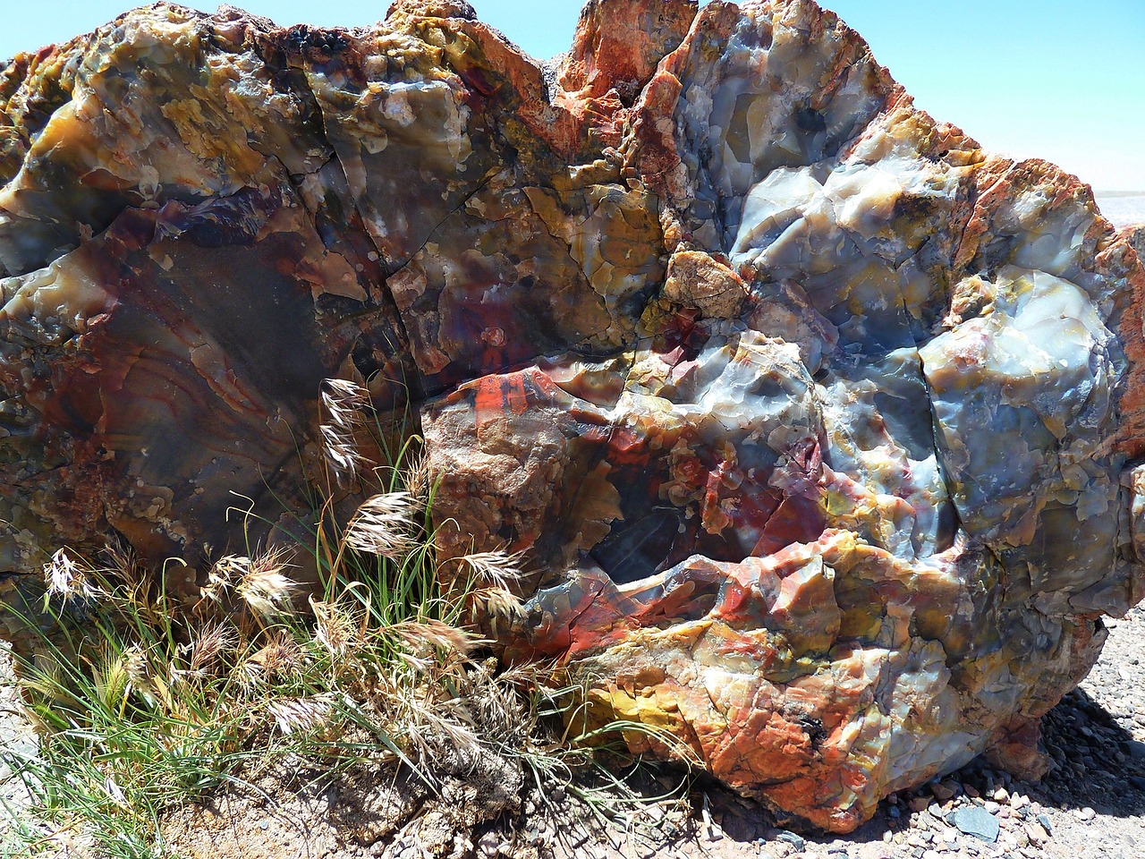
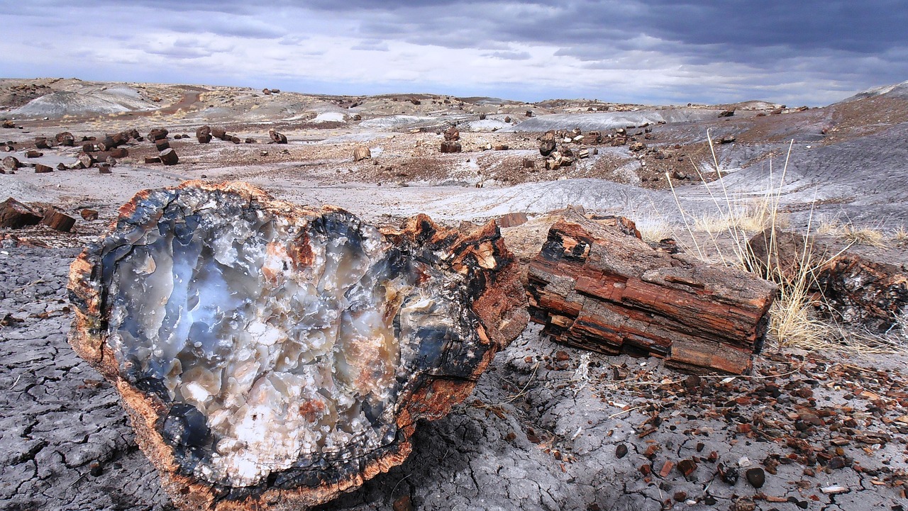
Petrified Forest National Park, located in northeastern Arizona, is a mesmerizing landscape known for its vast deposits of petrified wood that date back over 200 million years. Spanning about 221,390 acres, the park sits within the colorful badlands of the Painted Desert, where layers of sediment and bentonite clay glow in shades of red, orange, and pink under the sun.
This otherworldly terrain not only preserves one of the largest and most colorful concentrations of petrified wood in the world but also hosts an array of ancient fossils, revealing dinosaurs and other prehistoric life that once roamed this area. Beyond its paleontological significance, the park is rich in human history, with over 800 archeological and historical sites that include petroglyphs carved by early inhabitants.
The landscape of Petrified Forest National Park is a testament to the forces of nature and time, offering visitors a unique window into the Earth's geological and evolutionary past.
Biome at Petrified Forest National Park
Petrified Forest National Park, located in northeastern Arizona, features a desert biome that showcases a variety of geological wonders and fossil treasures. The park's varying altitudes from 5,340 feet to 6,230 feet (1,630 to 1,900 meters) above sea level supports a unique desert landscape. Keep on reading to learn more about the biome at Petrified Forest National Park
Airports Near Petrified Forest National Park
This is a list of the closest airports to the park, if you plan on flying into Petrified Forest click here to read our recommendations.
| Distance to Park | Drive Time | ||
| Holbrook Municipal Airport | 34.2 miles | 24 mins | Get Directions |
| Taylor Airport | 79.0 miles | 50 mins | Get Directions |
| Winslow-Lindbergh Regional Airport | 85.1 miles | 54 mins | Get Directions |
| Show Low Regional Airport | 95.3 miles | 1 hour 0 mins | Get Directions |
| Gallup Municipal Airport | 112.2 miles | 1 hour 1 min | Get Directions |
| St Johns Industrial Air Park | 132.9 miles | 1 hour 19 mins | Get Directions |
Cities Near Petrified Forest National Park
Here are some of the closest cities and towns near the park, take a look at our recommendations for where to stay when visiting Petrified Forest.

| Distance to Park | ||
| Holbrook | 39.2 miles | Get Directions |
| Joseph City | 52.0 miles | Get Directions |
| Snowflake | 67.9 miles | Get Directions |
| St. Johns | 73.5 miles | Get Directions |
| Ganado / Lókʼaahnteel | 74.5 miles | Get Directions |
| Winslow | 83.7 miles | Get Directions |
| Zuni / Halona Idiwan’a | 84.7 miles | Get Directions |
| Show Low | 93.5 miles | Get Directions |
| Window Rock / Tségháhoodzání | 94.0 miles | Get Directions |
| Fort Defiance / Tséhootsooí | 98.4 miles | Get Directions |
Petrified Forest National Park TimeZone
The timezone at Petrified Forest is America/Phoenix, the current time here is:
Sunrise and Sunset Times at Petrified Forest National Park
This table shows the sunrise and sunset times at Petrified Forest for the next 10 days, use it to plan your day around Petrified Forest stunning displays.
|
Date |
Sunrise |
Sunset |
| January 30, 2026 | 07:17 | 17:47 |
| January 31, 2026 | 07:17 | 17:48 |
| February 01, 2026 | 07:16 | 17:49 |
| February 02, 2026 | 07:15 | 17:50 |
| February 03, 2026 | 07:14 | 17:51 |
| February 04, 2026 | 07:13 | 17:52 |
| February 05, 2026 | 07:13 | 17:53 |
| February 06, 2026 | 07:12 | 17:54 |
| February 07, 2026 | 07:11 | 17:55 |
| February 08, 2026 | 07:10 | 17:56 |
Weather at Petrified Forest National Park
This table shows weather averages around the year at Petrified Forest National Park, it provides information on average rainfall, as well as maximum and minimum temperatures. Be sure to consult it when planning your trip.
|
Month |
Temperatures |
Precipitation |
Our Opinion |
|---|---|---|---|
|
Month |
Temperatures |
Precipitation |
Our Opinion |
|
Month |
Temperatures |
Precipitation |
Our Opinion |
|
Month |
Temperatures |
Precipitation |
Our Opinion |
|
Month |
Temperatures |
Precipitation |
Our Opinion |
|
Month |
Temperatures |
Precipitation |
Our Opinion |
|
Month |
Temperatures |
Precipitation |
Our Opinion |
|
Month |
Temperatures |
Precipitation |
Our Opinion |
|
Month |
Temperatures |
Precipitation |
Our Opinion |
|
Month |
Temperatures |
Precipitation |
Our Opinion |
|
Month |
Temperatures |
Precipitation |
Our Opinion |
|
Month |
Temperatures |
Precipitation |
Our Opinion |
| January | -6.2 °C / 9.4 °C | 3.8mm | Bad Weather |
| February | -4.2 °C / 12.5 °C | 3.9mm | Bad Weather |
| March | -1.3 °C / 16.3 °C | 5.1mm | Bad Weather |
| April | 3.3 °C / 21.3 °C | 1.0mm | Good Weather |
| May | 7.7 °C / 25.4 °C | 0.9mm | Perfect Weather |
| June | 13.7 °C / 32.1 °C | 2.2mm | Perfect Weather |
| July | 17.4 °C / 32.2 °C | 13.6mm | Perfect Weather |
| August | 15.7 °C / 30.7 °C | 10.0mm | Perfect Weather |
| September | 11.6 °C / 28.1 °C | 6.6mm | Perfect Weather |
| October | 4.7 °C / 21.6 °C | 6.3mm | Good Weather |
| November | -2.0 °C / 15.2 °C | 3.3mm | Bad Weather |
| December | -5.3 °C / 9.6 °C | 18.1mm | Bad Weather |
