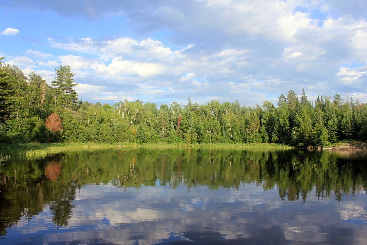
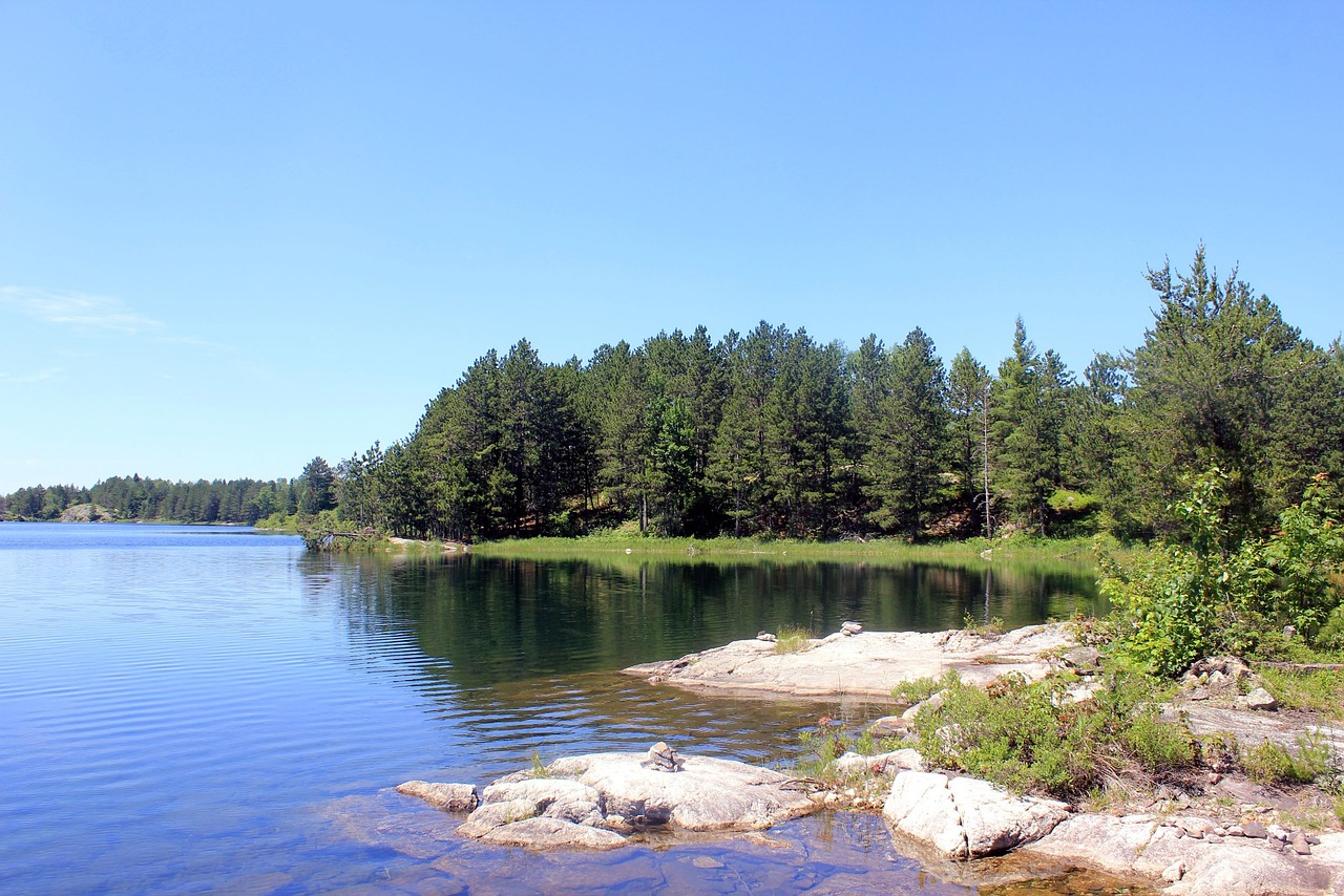
Situated in northern Minnesota, near the Canadian border, Voyageurs National Park is a water-centric paradise characterized by its vast network of lakes and waterways. Encompassing over 340 square miles of water, the park invites adventurers to explore its beauty by boat, kayak, or canoe.
Voyageurs is a mosaic of dense forests, wetlands, and rocky shores, providing habitat for wolves, moose, beavers, and bald eagles. The park's name pays homage to the French-Canadian fur traders, known as "voyageurs," who navigated these waters in birch bark canoes centuries ago.
In winter, the frozen landscapes transform into a wonderland for snowmobiling, cross-country skiing, and ice fishing. The park's dark skies also offer some of the best northern lights viewing in the United States.
Biome at Voyageurs National Park
Voyageurs National Park, located in northern Minnesota, is a pristine wilderness area characterized by its vast water network and rich, diverse ecosystems. The park's landscape is a mosaic of water, forests, wetlands, and rocky outcrops, shaped by glaciers thousands of years ago. Keep on reading to learn more about the biomes at Voyageurs National Park
Airports Near Voyageurs National Park
This is a list of the closest airports to the park, if you plan on flying into Voyageurs click here to read our recommendations.
| Distance to Park | Drive Time | ||
| Fort Frances Municipal Airport | 25.2 miles | 27 mins | Get Directions |
| Falls International/Einarson Field | 39.1 miles | ||
| Eveleth/Virginia Municipal Airport | 138.2 miles | 1 hour 28 mins | Get Directions |
| Range Regional Airport | 139.6 miles | 1 hour 30 mins | Get Directions |
| Ely Municipal Airport | 167.2 miles | 1 hour 50 mins | Get Directions |
| Atikokan Municipal Airport | 172.1 miles | 2 hours 5 mins | Get Directions |
| Grand Rapids/Itasca County-Gordon Newstrom Field | 210.7 miles | 2 hours 20 mins | Get Directions |
| Dryden Regional Airport | 217.2 miles | 2 hours 37 mins | Get Directions |
| Kenora Airport | 225.8 miles | 2 hours 42 mins | Get Directions |
| Ignace Municipal Airport | 247.4 miles | 3 hours 15 mins | Get Directions |
Cities Near Voyageurs National Park
Here are some of the closest cities and towns near the park, take a look at our recommendations for where to stay when visiting Voyageurs.

| Distance to Park | ||
| Fort Frances | 40.0 miles | Get Directions |
| International Falls | 40.6 miles | Get Directions |
| Emo | 71.7 miles | Get Directions |
| Atikokan | 96.8 miles | Get Directions |
| Ely | 100.9 miles | Get Directions |
| Virginia | 111.6 miles | Get Directions |
| Chisholm | 112.3 miles | Get Directions |
| Hibbing | 119.4 miles | Get Directions |
| Sioux Narrows | 134.5 miles | Get Directions |
| Ignace | 135.3 miles | Get Directions |
Voyageurs National Park TimeZone
The timezone at Voyageurs is America/Rainy_River, the current time here is:
Sunrise and Sunset Times at Voyageurs National Park
This table shows the sunrise and sunset times at Voyageurs for the next 10 days, use it to plan your day around Voyageurs stunning displays.
|
Date |
Sunrise |
Sunset |
| January 16, 2026 | 07:55 | 16:47 |
| January 17, 2026 | 07:54 | 16:48 |
| January 18, 2026 | 07:53 | 16:50 |
| January 19, 2026 | 07:52 | 16:51 |
| January 20, 2026 | 07:52 | 16:53 |
| January 21, 2026 | 07:51 | 16:54 |
| January 22, 2026 | 07:50 | 16:56 |
| January 23, 2026 | 07:49 | 16:57 |
| January 24, 2026 | 07:48 | 16:59 |
| January 25, 2026 | 07:46 | 17:00 |
Weather at Voyageurs National Park
This table shows weather averages around the year at Voyageurs National Park, it provides information on average rainfall, as well as maximum and minimum temperatures. Be sure to consult it when planning your trip.
|
Month |
Temperatures |
Precipitation |
Our Opinion |
|---|---|---|---|
|
Month |
Temperatures |
Precipitation |
Our Opinion |
|
Month |
Temperatures |
Precipitation |
Our Opinion |
|
Month |
Temperatures |
Precipitation |
Our Opinion |
|
Month |
Temperatures |
Precipitation |
Our Opinion |
|
Month |
Temperatures |
Precipitation |
Our Opinion |
|
Month |
Temperatures |
Precipitation |
Our Opinion |
|
Month |
Temperatures |
Precipitation |
Our Opinion |
|
Month |
Temperatures |
Precipitation |
Our Opinion |
|
Month |
Temperatures |
Precipitation |
Our Opinion |
|
Month |
Temperatures |
Precipitation |
Our Opinion |
|
Month |
Temperatures |
Precipitation |
Our Opinion |
| January | -21.9 °C / -8.7 °C | 42.5mm | Bad Weather |
| February | -21.5 °C / -6.4 °C | 35.8mm | Bad Weather |
| March | -11.9 °C / 3.1 °C | 42.4mm | Bad Weather |
| April | -4.0 °C / 10.7 °C | 44.5mm | Bad Weather |
| May | 2.5 °C / 17.8 °C | 82.3mm | Tolerable Weather |
| June | 8.9 °C / 22.9 °C | 112.0mm | Good Weather |
| July | 12.0 °C / 25.7 °C | 84.4mm | Good Weather |
| August | 10.6 °C / 24.6 °C | 90.9mm | Good Weather |
| September | 6.4 °C / 19.4 °C | 101.8mm | Good Weather |
| October | -1.0 °C / 9.6 °C | 56.7mm | Bad Weather |
| November | -7.2 °C / 1.6 °C | 49.1mm | Bad Weather |
| December | -17.5 °C / -7.2 °C | 42.1mm | Bad Weather |
