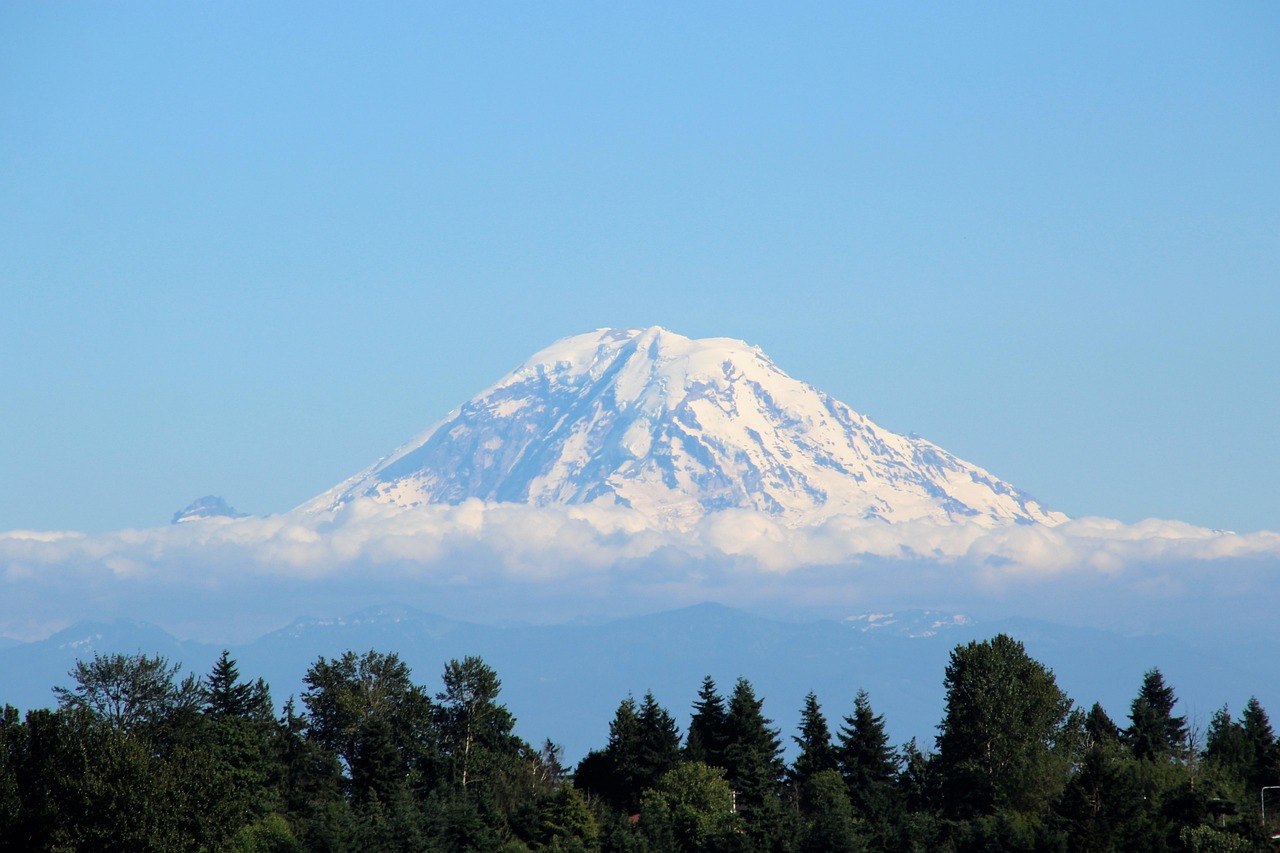
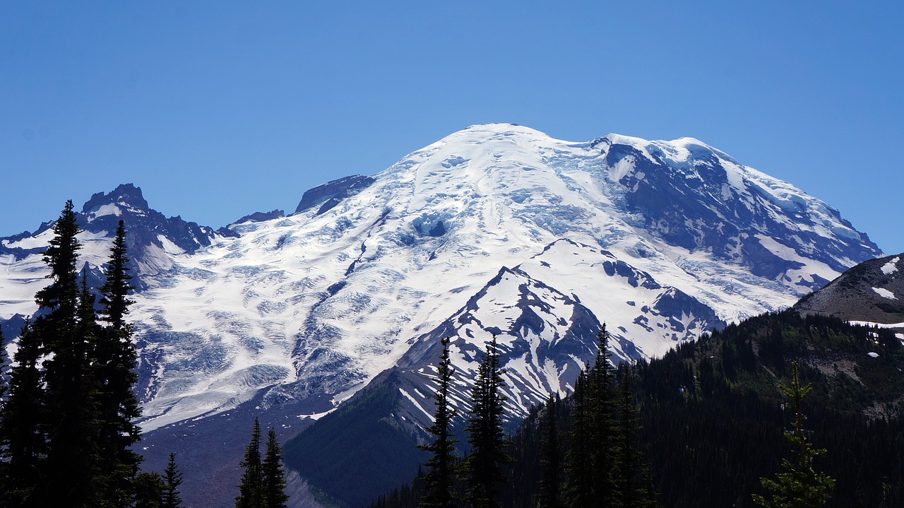
Encompassing 236,381 acres in the state of Washington, Mount Rainier National Park is a natural wonderland centered around Mount Rainier itself, a massive stratovolcano standing at 14,411 feet - the highest peak in the Cascade Range. This iconic mountain is not only one of the most prominent peaks in the United States but also one of the most glaciated, featuring expansive glaciers and snowfields that feed into several rivers.
The park's diverse ecosystems range from lush old-growth forests at lower elevations to subalpine wildflower meadows and the stark, otherworldly landscapes of the mountain's upper slopes. With over 260 miles of maintained trails, visitors can explore the park's beauty through hiking, climbing, and camping amidst its breathtaking scenery. The park is a haven for wildlife, including black bears, mountain goats, and a diverse array of bird species, making it a critical habitat for conservation. Mount Rainier National Park's dramatic landscape, ecological diversity, and recreational opportunities make it a year-round destination for adventurers and nature lovers alike.
Biome at Mount Rainier National Park
Mount Rainier National Park, located in Washington State, boasts a rich variety of biomes that span from lowland old-growth forests to alpine tundra, due to its dramatic elevation gain from 1,600 feet (490 meters) to over 14,000 feet (4,300 meters) above sea level. Keep on reading to learn more about the biomes at Mount Rainier National Park
Airports Near Mount Rainier National Park
This is a list of the closest airports to the park, if you plan on flying into Mount Rainier click here to read our recommendations.
| Distance to Park | Drive Time | ||
| Mcchord Field (Joint Base Lewis-Mcchord) Airport | 81.1 miles | 1 hour 8 mins | Get Directions |
| Gray Army Air Field (Joint Base Lewis-Mcchord) Airport | 85.6 miles | 1 hour 11 mins | Get Directions |
| Bowers Field | 95.0 miles | ||
| Ed Carlson Memorial Field - South Lewis County Airport | 97.7 miles | 1 hour 10 mins | Get Directions |
| Tacoma Narrows Airport | 103.2 miles | 1 hour 26 mins | Get Directions |
| Olympia Regional Airport | 104.4 miles | 1 hour 28 mins | Get Directions |
| Sanderson Field | 114.2 miles | ||
| Chehalis-Centralia Airport | 115.7 miles | 1 hour 21 mins | Get Directions |
| Renton Municipal Airport | 119.2 miles | 1 hour 40 mins | Get Directions |
| Seattle-Tacoma International Airport | 123.4 miles | 1 hour 39 mins | Get Directions |
Cities Near Mount Rainier National Park
Here are some of the closest cities and towns near the park, take a look at our recommendations for where to stay when visiting Mount Rainier.

| Distance to Park | ||
| Enumclaw | 43.5 miles | Get Directions |
| Prairie Ridge | 44.0 miles | Get Directions |
| Graham | 45.3 miles | Get Directions |
| Bonney Lake | 49.2 miles | Get Directions |
| South Hill | 50.9 miles | Get Directions |
| Elk Plain | 51.6 miles | Get Directions |
| Frederickson | 53.7 miles | Get Directions |
| Sumner | 53.8 miles | Get Directions |
| Puyallup | 55.5 miles | Get Directions |
| Spanaway | 58.1 miles | Get Directions |
Mount Rainier National Park TimeZone
The timezone at Mount Rainier is America/Los_Angeles, the current time here is:
Sunrise and Sunset Times at Mount Rainier National Park
This table shows the sunrise and sunset times at Mount Rainier for the next 10 days, use it to plan your day around Mount Rainier stunning displays.
|
Date |
Sunrise |
Sunset |
| January 16, 2026 | 07:45 | 16:48 |
| January 17, 2026 | 07:44 | 16:50 |
| January 18, 2026 | 07:43 | 16:51 |
| January 19, 2026 | 07:42 | 16:52 |
| January 20, 2026 | 07:41 | 16:54 |
| January 21, 2026 | 07:41 | 16:55 |
| January 22, 2026 | 07:40 | 16:57 |
| January 23, 2026 | 07:39 | 16:58 |
| January 24, 2026 | 07:38 | 17:00 |
| January 25, 2026 | 07:37 | 17:01 |
Weather at Mount Rainier National Park
This table shows weather averages around the year at Mount Rainier National Park, it provides information on average rainfall, as well as maximum and minimum temperatures. Be sure to consult it when planning your trip.
|
Month |
Temperatures |
Precipitation |
Our Opinion |
|---|---|---|---|
|
Month |
Temperatures |
Precipitation |
Our Opinion |
|
Month |
Temperatures |
Precipitation |
Our Opinion |
|
Month |
Temperatures |
Precipitation |
Our Opinion |
|
Month |
Temperatures |
Precipitation |
Our Opinion |
|
Month |
Temperatures |
Precipitation |
Our Opinion |
|
Month |
Temperatures |
Precipitation |
Our Opinion |
|
Month |
Temperatures |
Precipitation |
Our Opinion |
|
Month |
Temperatures |
Precipitation |
Our Opinion |
|
Month |
Temperatures |
Precipitation |
Our Opinion |
|
Month |
Temperatures |
Precipitation |
Our Opinion |
| January | 1.2 °C / 8.8 °C | 52.8mm | Bad Weather |
| February | 1.6 °C / 9.6 °C | 108.4mm | Bad Weather |
| April | 4.3 °C / 14.6 °C | 81.6mm | Good Weather |
| May | 7.9 °C / 19.1 °C | 48.7mm | Perfect Weather |
| June | 10.5 °C / 22.3 °C | 33.7mm | Perfect Weather |
| July | 12.4 °C / 26.3 °C | 2.1mm | Perfect Weather |
| August | 12.9 °C / 26.8 °C | 6.7mm | Perfect Weather |
| September | 10.4 °C / 22.5 °C | 37.9mm | Perfect Weather |
| October | 6.6 °C / 17.1 °C | 82.6mm | Good Weather |
| November | 3.4 °C / 11.5 °C | 97.2mm | Tolerable Weather |
| December | 1.0 °C / 7.4 °C | 138.1mm | Bad Weather |
